
![]()
![]()
![]()
![]()
![]()
![]()
![]()
![]()
The data
The data used in this case study exists as two raw videography images of the Kidman springs area that are situated on calcareous red loam soil. These images have been classified into five land cover types - canopy, shadow, bare soil, perennials and annuals. One of these sites is very close to a watering hole; the other is in what was considered to be an exclosure that is within an area which is unlikely to have been grazed by cattle.
Kidman Springs 1 (KS1)
0-50 metres
14kb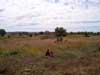
|
50-100 metres
15kb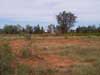
|
Kidman Springs 5 (KS5)
0-50 metres
20kb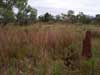
|
50-100 metres
21kb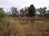
|