Case Study 2: Weed monitoring in a river catchmentBackground information
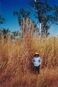
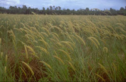
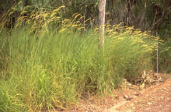
Both grasses were introduced to the NT as experimental pasture for the cattle industry. They share many similarities, including their African origin, prolific seed production and ability to colonise non-pastoral land. Both grasses have thrived in the tropical environment of northern Australia. The introduction and rapid spread of Mission and Gamba Grass has greatly increased fuel loading (tonnes per hectare of flammable material) of the wooded savanna ecosystem common throughout the region. This substantial increase in fuel loading, combined with the later curing time of these grasses, has the potential for a major change in the fire regime across the entire Top End. Further information on Gamba and Mission Grass is provided on the
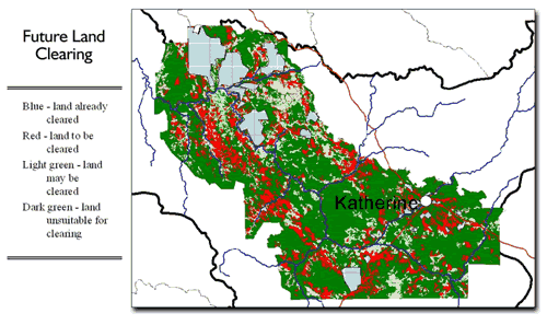
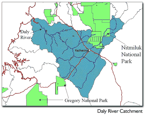
Northern Territory Fire and Rescue Service (NTFRS) web site at You have been asked to design a monitoring program for the Daly River catchment to be used as a model for the rest of the state. No budget has been set at this point, and part of your job is to provide estimates of the costs involved. The time frame for the project is set at 5 years. There are grand plans for the future development of the catchment. There are approximately 4,000 km2 suitable for cotton growing and other horticultural crops (mainly mangoes and cashews). In addition, with the improvement of pastures, more intensive cattle grazing will be possible. To give students an idea of the extent of the proposed development, a map of part of the catchment, classified in relation to different future land uses, is shown. Aims
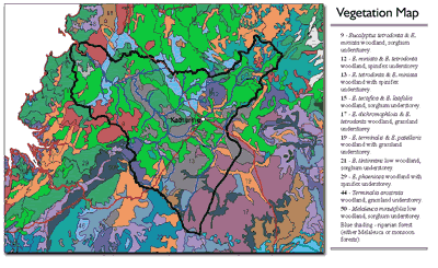
Location of catchment Much of the catchment is used for pastoralism, with some area in conservation reserves and the remaining area is aboriginal land. Existing vegetation 9 - Eucalyptus tetrodonta & E. miniata woodland, sorghum understorey 12 - E. miniata & E. tetrodonta woodland, spinifex understorey 13 - E. tetrodonta & E. miniata woodland with spinifex understorey 15 - E. tectifica & E. latifolia woodland, sorghum understorey 17 - E. dichromophloia & E. tetrodonta woodland, grassland understorey 19 - E. terminalis & E. patellaris woodland with grassland understorey 21 - E. tintinnans low woodland, sorghum understorey 29 - E. phoenicea woodland with spinifex understorey 44 - Terminalia arostrata woodland, grassland understorey 50 - Melaleuca minutifolia low woodland, sorghum understorey Blue shading - riparian forest (either Melaleuca or monsoon forests) References
When preparing your proposal make sure to note the following Length 1500-2500 words (please don't go over this limit) In your proposal outlining and justifying the weed-monitoring program for the minister to review, be sure to follow the basic structure below: 1.Title
5. Costs, time and staff required
6. References
|